The fastest way to work with MGRS on iPhone.
Receive a grid over radio. Paste it. See distance and bearing in under a second. No menus. No data signal needed. Built for land navigation training, SAR, and wildland fire.

Every feature exists to reduce friction under stress.
If a feature didn't make you faster on a ruck, in a search grid, or holding a radio in one hand, it didn't make the cut.
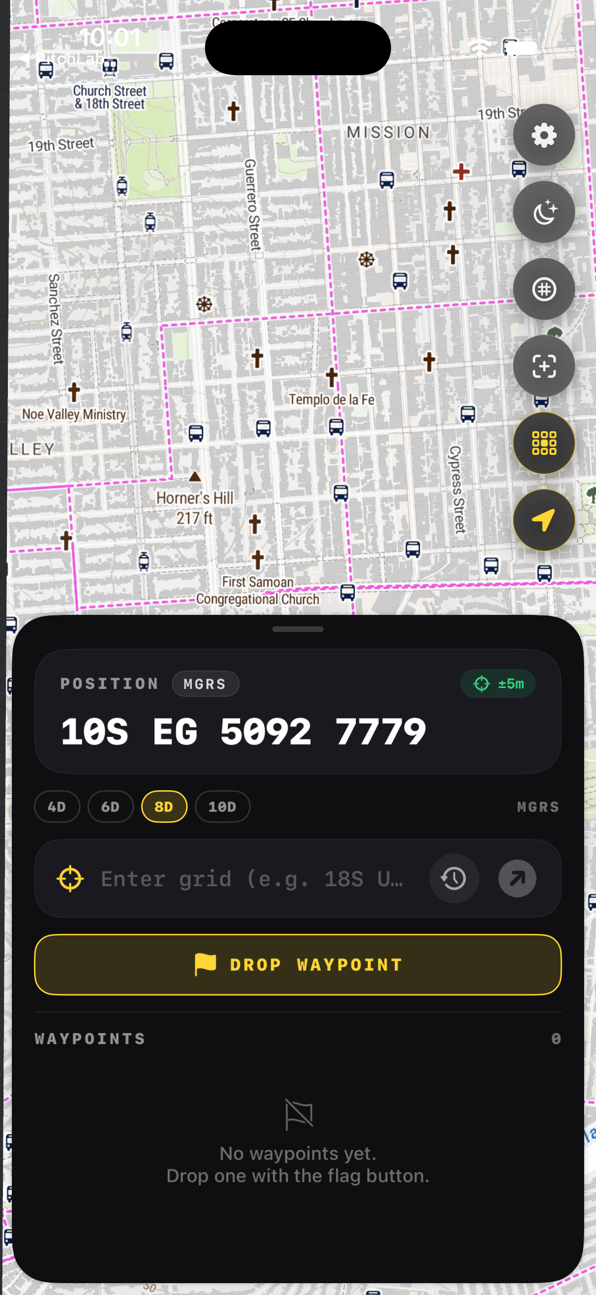
Your grid, always glanceable
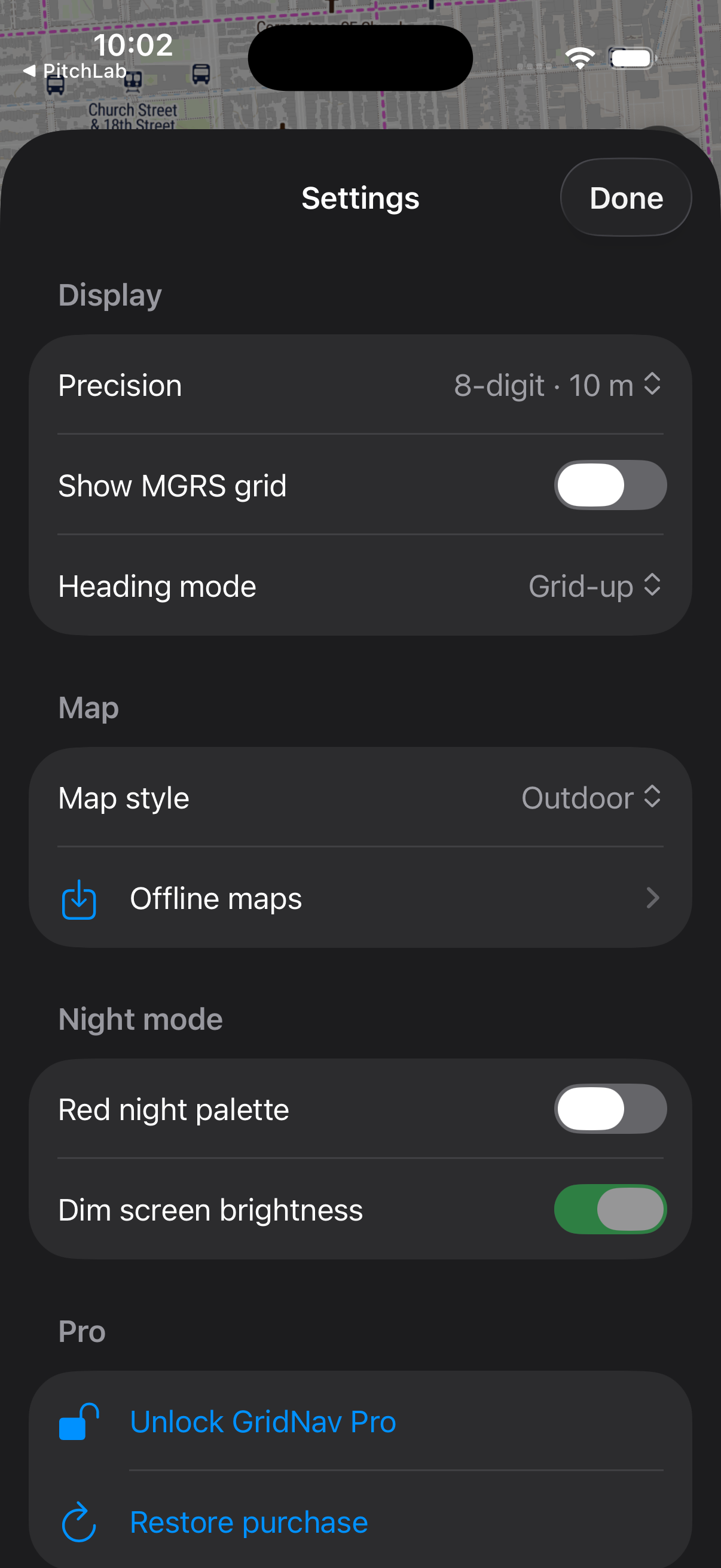
Big high-contrast MGRS, UTM, or Lat/Lon at the precision you need. 4, 6, 8, or 10-digit. One tap to copy.
From radio to bearing in seconds
Persistent grid input bar. Type or paste a coordinate, get instant distance and bearing. Single-step workflow.
Pre-downloaded regions, zero signal
Pick a box, choose detail, take it to the field. Map tiles, grid overlay, and waypoints all work without signal.
Smooth MGRS lines at every zoom
GPU-rendered MGRS grid lines from GZD down to 100m. Pan and zoom without lag. Labels at intersections.
Drop, label, and navigate
One tap to mark current position. Color-code, label, and tap to navigate. Unlimited with GridNav Pro.
Red palette, dark adaptation preserved
Red-on-black night mode with optional auto brightness dim. Designed for keeping your night vision intact.
Designed to be readable at arm's length, under load.
No tactical aesthetic overload. No cluttered menus. A precision instrument, not a cosplay UI.
The MVP succeeds the moment a user says, “this is faster and easier than MilGPS.”
Live grids, offline maps, and bearings in your pocket.
MGRS, UTM, and Lat/Lon at any precision. Paste-to-orient input, offline region downloads, a GPU-smooth grid overlay, unlimited waypoints, and a red night mode. Built for land nav, SAR, and wildland fire.